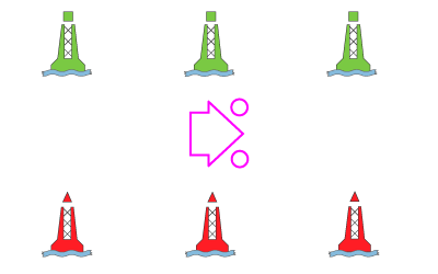
Aids to Navigation
The International Association of Marine Aids and Lighthouse Authorities (IALA) was established in 1957 as the International Association of Lighthouse Authorities to develop recommendations on new technologies and improved practices to aid in safety at sea. Their most notable accomplishment is the development of the IALA Buoyage System. The IALA finally had to settle on a system that divided the planet into (2) distinct regions: Region A and Region B.
In 1971, (2) maritime accidents occurred in the Straits of Dover; the German flagged Brandenburg and the Peruvian flagged Niki. These (2) accidents, resulted in the loss of 51 lives, occurred less than 2 months apart, and were caused by striking the same well marked sunken wreckage of the Texaco Caribbean. This became the impetus to bring about worldwide changes to the confusing buoyage systems of the time.
Region A: Includes parts of the Atlantic Ocean, Africa, Europe, Asia, Middle East, Australia, Indian Ocean, and parts of the Pacific Ocean.
Region B: Includes parts of the Atlantic Ocean, North America, Central America and South America, Philippines, Japan, Korea, and parts of the Pacific Ocean.
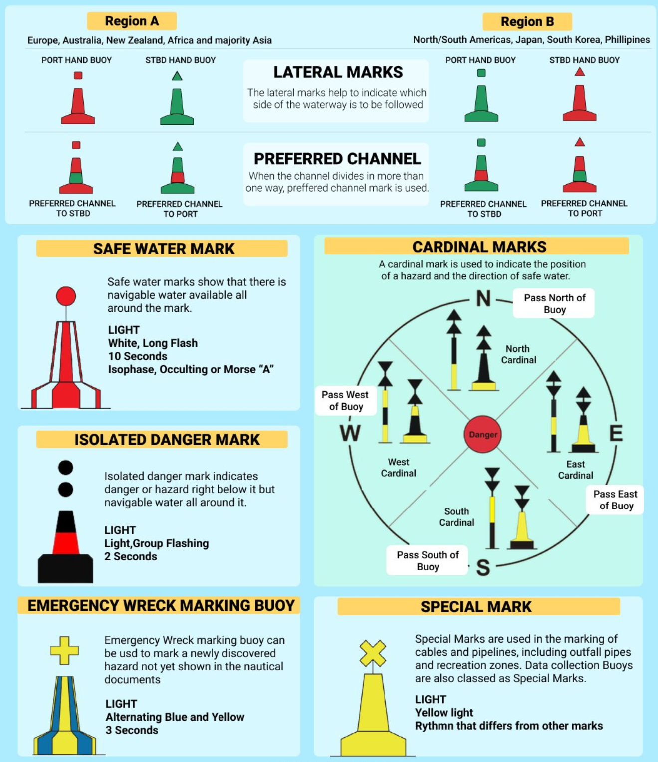
The most noteworthy difference is found in the Lateral Buoy Marks. IALA-A and IALA-B differ as to what color marks which side of the channel when returning from sea.
In the US, we use the region B system. If numbered, starboard lateral marks will be red and have even numbers, while port will have green with odd numbers. Top marks for starboard is always conical or pointed, while port will always be a square or flat top.
Lateral markers play a crucial role in providing guidance and information to boaters as they navigate through waterways. They indicate the direction of navigation, safe water passages, and potentially hazardous areas.
To stay in the channel when returning from the sea, the numbers will increase and you will leave the red marks to starboard (Red Right Returning):
Buoys can be identified by their color, shape and number as well as the light pattern if lighted. Five buoy types – cardinal, lateral, isolated danger, special, and safe water. Lateral aids indicate the sides – most often sides of a channel Non Lateral aids do not indicate the sides – mark a navigational feature such as Special marks – anchorages, fishing grounds, dredging/spoil areas. They may be lighted, fixed or flashing yellow light, shape of buoys close to it.
Buoy – floating, anchored to bottom, cans and nuns
Beacon – structure permanently fixed to bottom (daybeacon is unlighted)